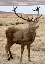
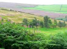
The Peak District had been on our list of 'must see' places for some time, an ideal place for a long weekend with just 130 miles separating our home town from Derbyshire's rolling hills, green valleys, 'wuthering heights', misty moors and picture postcard villages. So, armed with a pre-booked cottage, a pre-planned list of walks and a pre-packed bag of all-weather gear we headed for the hills.
Having lived in Glasgow, London and Manchester as a child I consider myself a veteran townie, but I'd actually been to the Peak District years before, and as a young adolescent had experienced what were possibly my first views of rugged and rural scenery. With just a few hazy but happy childhood memories of Old Glossop and the dales, combined with Derbyshire and Yorkshire parentage, the journey northwards felt a little like 'going home.'
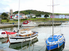
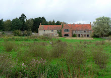
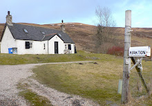
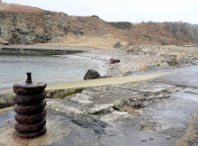
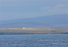
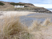
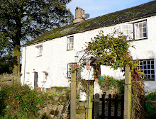
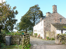
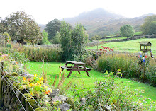
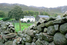
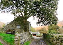
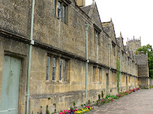
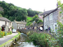
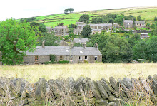
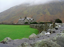
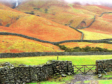
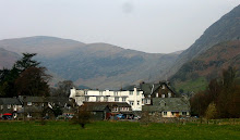
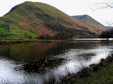
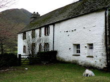
After a quick lunch stop in the historic and hilly mill town of Matlock we arrived at our destination. Pepper Pot Cottage is part of a remote but enterprising working farm nestled on the western edge of Hope Valley just a few miles from Castleton. It was the perfect base for our explorations, walks and photos, central to both the 'White Peak' area (carboniferous limestone) in the centre and 'Dark Peak' (millstone grit) areas on the northern, western and eastern fringes.
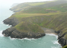
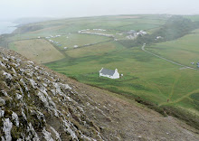
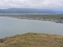
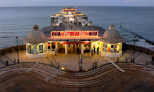
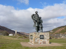
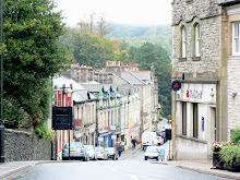
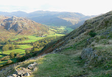
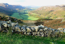
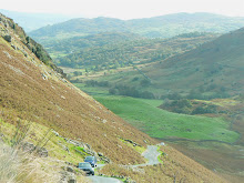
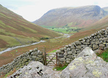
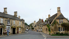
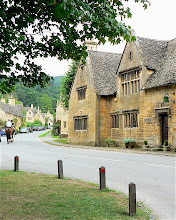
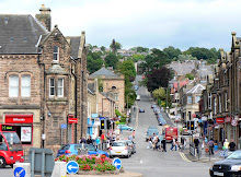
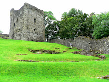
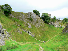
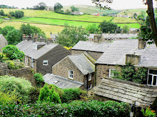
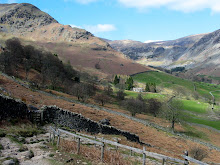
Our first walk was a short, sharp hike up the hill to Peveril Castle, which of course gave the town it's name. Allegedly built for the illegitimate son of William the Conqueror after the Norman conquest of 1066, what now remains of the castle is less significant than the views afforded by it's position, high above the pretty pale grey limestone houses of Castleton with panoramic views of Hope Valley, Mam Tor and the Ridge that separated it from Edale Valley beyond - in fact, a bird's eye view of the complete walk planned for the next day. But in the meantime there was something I'd been looking forward to seeing at close quarters ... .
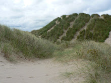
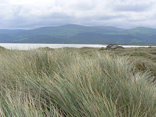
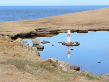
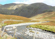
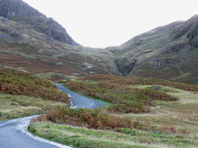
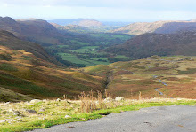
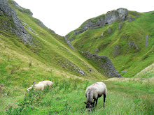
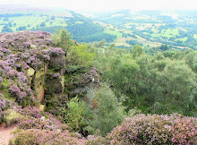
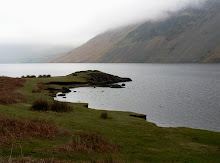
Having googled much of the area in advance I was keen to see Winnats Pass, a narrow winding road which climbs its way upwards 1300' from Hope Valley through a steeply sided dramatic cleft in the hill, surrounded by towering limestone pinnacles. The permanent closure of the main A625 road at Mam Tor in 1979 due to subsidence has resulted in Winnats Pass being heavily used by road traffic. However, the narrowness of the road and its 20% (1 in 5) gradient has caused it to be closed to buses, coaches and vehicles over 7.5 tonnes in weight. Winnats Pass (the name being a corruption of 'Wind Gates'), was once thought to have originated as a giant collapsed cavern, however a more recent explanation is that it was a ravine between the coral reefs that originally formed the limestone. But it also has a more sinister tale to tell.
Local legend has it that the pass is haunted by the ghosts of two ill-fated lovers, murdered while they were on their way to be married at the ‘runaway church’ in the Peak Forest. The Peak Forest chapel had become Derbyshire’s own Gretna Green in a way and enabled couples who were perhaps facing objections to their marriage, to be legally wed. This is exactly what Allan and Clara, a young couple from Scotland, were on their way to do in 1758.
The couple made their way to Castleton and stopped for a rest at an inn. A group of miners were also in the inn, quite raucous and drunk, and noticed that the couple were dressed in fine clothes. They overheard the landlord give directions to the chapel by way of Winnats Pass and once Allan and Clara had left they continued their drinking until the landlord threw them out. The group of men decided that by the look of the fine clothes of the couple it was likely that they would be carrying a substantial amount of money. They decided to rob them and so they set off to intercept the couple at Winnats Pass.
As Allan and Clara were halfway through the Pass the miners jumped out and dragged them from their horses. They found that the couple did indeed have some money - £200 - which they stole. Allan and Clara pleaded for their lives but to no avail. Ten years later their bodies were discovered in a mineshaft. Sadly they never did make it to the ‘runaway chapel’ but their spirits are said to still wander Winnats Pass and sometimes can be heard pleading for their lives. We neither saw nor heard evidence of the ill-fated lovers, but as we walked through and over Winnats Pass we did hear a couple of resident sheep who seemed to be pleading a lot (or perhaps it was bleating).
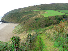
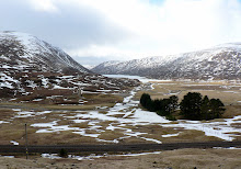
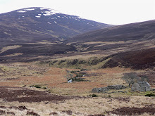
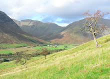
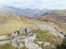
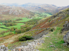
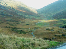
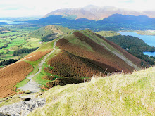
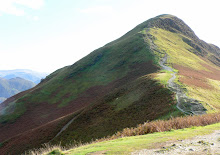
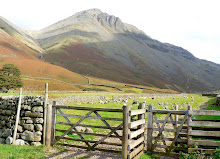
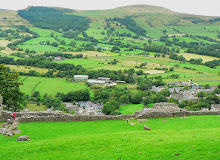
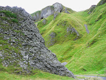
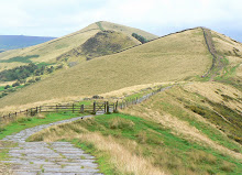
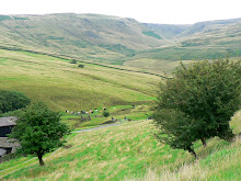
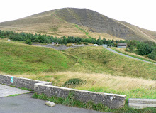
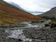
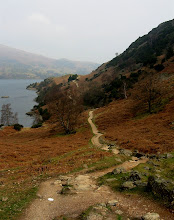
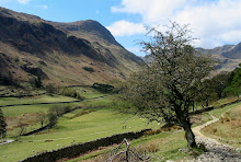
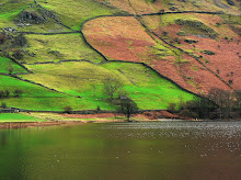
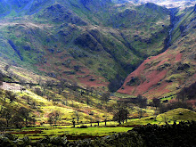
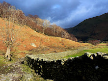
The next morning we went back into Castleton for the start of our 7 mile circular trek up to Mam Tor, which promised spectacular scenery and views across both Hope and Edale valleys. Leaving the village behind us, we began the steep and relentless ascent over wet and rocky terrain, past Peveril Castle through Cavedale, a spectacular u-shaped valley flanked on either side by limestone escarpments. With ominous dark clouds looming behind us, we continued onwards and upwards to Old Moor, stopping only briefly for shelter behind a 'dry' stone wall as the heavens opened and the rain descended. We'd come too far to give up - Mam Tor, the pinnacle of our walk, lay ahead. And as we followed the bridleway across the moor to the foot of Mam Tor the driving rain stopped just long enough for us to start the steep ascent to the top.
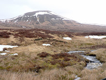
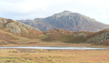
Mam Tor (translated literally as 'heights of the mother') is a 517 m (1696 ft) hill, also known as the Shivering Mountain on account of the instability of its lower shale layers. The summit is encircled by a late Bronze Age and early Iron Age hill fort, with occupation from around 1200 BC. The earliest remaining features are two Bronze Age burial mounds, one just below the summit and the other on the summit itself. At a later stage over a hundred small platforms were levelled into the hill near the summit, allowing inhabited timber huts to be constructed. We know all of this because we researched it. We saw no trace of Iron or Bronze age features because low cloud had by this time descended on the summit obliterating all views other than those of our feet!
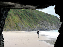
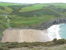
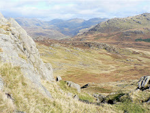
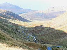
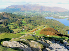
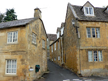
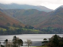
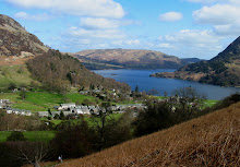
As if to reward our patient and valiant efforts to battle through the elements, the low cloud suddenly lifted, the mist cleared, the sun appeared, and superb views across the ridge ahead to Back Tor and the Hope and Edale valleys to either side were revealed in all their glory. But feeling a bit weather worn and weary, and not wishing to push our luck further, we turned off the track at the 'saddle' of the ridge at Hollins Cross and made our descent back into Castleton, stopping for stunning vistas, photographs and picnic en route. Once back in the village we explored some of it's charming 'cottage' and 'stream'-lined lanes before taking a historical route back to Pepper Pot Cottage - via the village of Eyam.
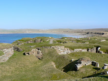
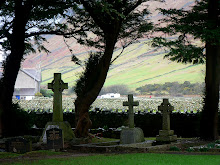
Eyam has the unfortunate and morbid history of being a plague village, having lost 260, nearly two thirds of it's villagers to the 'most dangerous disease known to man' - the Bubonic plague. The Great Plague entered London in the 17th Century and came to Eyam by the most unfortunate of mishaps - carried by fleas festering in a box of cloth brought from the capital for the village tailor. But Eyam's tale is also one of courage and altruism as for 14 months the village voluntarily quarantined itself in order to contain and prevent the spread of infection beyond it's boundaries. The cottages remain, as do the many clusters of graves, found not in the church graveyard but scattered around the outskirts of the village; whole families buried hurriedly and by their own kin, without funeral service or gatherings, and with only damage limitation in mind.
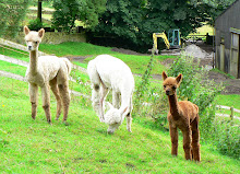
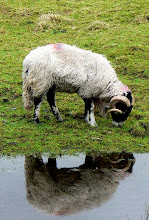
Day 3 began outside Pepper Pot cottage down on the farm! Before embarking on yet more peaks, we took our own quick peek at a field full of four-legged furry farm animals - Alpacas. True to the 'fearlessness of youth', the baby Alpacas couldn't resist checking us out at close quarters, and seemed as interested in us as we were in them. One was particularly curious about the farm cat, but the interest wasn't mutual and ended in a chase round the field before the cat escaped to safety under the farm gate. Hard as it was to tear myself away from these curious and incredibly cute animals, we were soon heading northwards for the nostalgic return to Old Glossop. Last there in 1964 on a youth club Bank Holiday walk, I knew it was unlikely I would remember much of the area, but this didn't detract from the occasion. The mills of Old Glossop had long since closed, but the area had lost none of its northern charm!
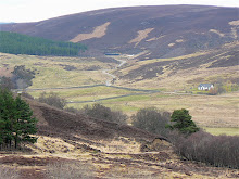
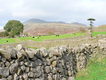
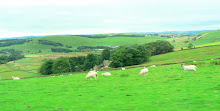
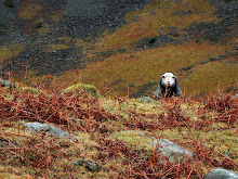
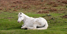
Our first walk began from the eastern fringe of Old Glossop, a short 2 mile, circular, low-rise 'wildlife' walk around Shire Hill - and we had high hopes of spotting the rare and beautiful purple hairstreak butterflies which are purportedly residents of the hill. Whilst we didn't get to see the butterflies we saw 2 playful horses galloping across a field, a herd of cows lazing around in a field and a patchwork of pretty purple heather carpeting several other fields. The walk we followed traced a winding stream which threaded its way through a narrow valley before disappearing out of view at the base of Snake Pass. (Snake Pass is the scenic, high-level, historic section of the A57 that was once the stagecoach (and only) route connecting the High Peak to Sheffield). But at this point our path followed instead the curve of Shire Hill, then a short climb up it, a walk along an ancient track on the edge of a forest and finally a short descent back down into Old Glossop.
The nostalgic mood continued for me, as we then managed to locate what I believe to be the site of several idyllic Sunday School outings made from Manchester. Through the eyes of a child, Manor Park was 'the countryside'. It was hilly, had a stream wandering through it (which could be paddled in!) and was filled with more trees than any town park I'd ever been in! With my head still trying to put the pieces of long distant and patchy memories together, we left Glossop behind and headed for Hayfield.
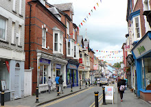
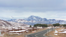
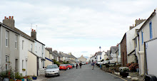
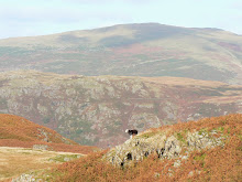
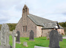
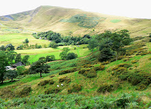
Hayfield is an old village which was once a staging post on the pack-horse route across the Pennines from Cheshire to Yorkshire. The age of the settlement can be seen from the old cottages which survive around the centre of the old village, and some of the farms around here date from the late 17th century. In the 19th century cotton arrived, followed by the railway, and Hayfield grew enormously so it now straggles down the Sett valley and merges into Birch Vale and New Mills. However the old centre of the village, to the east of the main road which cuts the village in two, is quite quaint, with a lovely old church and lots of old cottages. But the main importance of Hayfield for the visitor is that it's the gateway to the west side of Kinder and overlooked by Kinder Scout, a high windswept upland gritstone plateau, most of which stands at around 600 metres above sea level. This is the largest and grandest of the great upland areas of the so-called 'Dark Peak' and it forms an imposing and fascinating area.
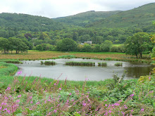
The plan was to explore this pretty village before walking up towards Kinder Reservoir and back into Hayfield. The reality was a missed turning, a climb up the wrong hill and a car-park ticket giving us 2 hours - all of which resulted in the walk being cut short. However this didn't seem to matter as what we'd seen satisfied our curiosity and energy levels, so we were happy to take an earlier, unscheduled and unknown route back across the Peak District from west to east, where we had an unplanned but fascinating stop at Derwent Reservoir!
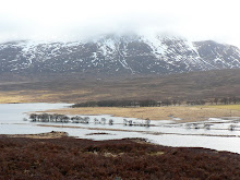
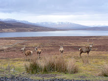
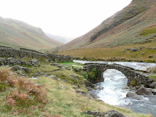
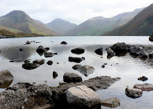
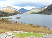
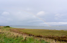
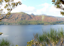
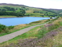
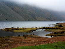
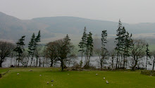
The Upper Valley of the Derwent is a deep valley surrounded by gritstone edges and dominated by three great reservoirs, constructed by the Derwent Valley Water Board primarily to provide water for Sheffield, Derby, Nottingham and Leicester. Two large dams were constructed and opened in 1916, but it was the construction of Ladybower Dam in 1935 that caused much controversy - because it involved flooding two villages, Ashopton and Derwent. All that remains is the packhorse bridge which was dismantled and re-erected, although the village spookily re-emerges during hot summers and periods of severe drought! Another claim to fame for the reservoirs is their association with the Dambuster Squadron of the RAF, for they used the Derwent to practice their low level flying techniques in readiness for dropping the famous Barnes Wallis' bouncing bombs during raids on German dams. Our walk didn't reveal any RAF bombers or watery rooftops over the surface of the reservoir, but our imaginations filled in the gaps!
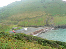
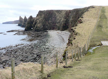
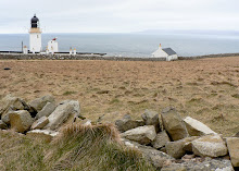
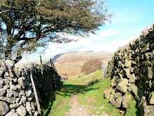
Our journey back to base took us through the village of Hathersage, famous for its associations with Robin Hood and the Eyre family - Bronte land! But our attention was drawn away from the village to a large, imposing and impressive gritstone edge in the distance. Situated on the moors north of Hathersage, and visible from miles away down in the Hope Valley, Stanage Edge stretches for a length of approximately six kilometres (3.5 miles) from its northern tip at Stanage End to the southern point near the Cowper Stone. The map revealed that Stanage Edge was accessible by road, so we made one last stop to the car park at the top, and one last walk across thickly heather clad heathland to the edge, for outstanding views over Hope Valley, our 'home' for one last night ... but not before finding somewhere to eat!
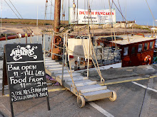
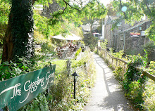
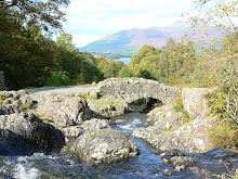
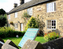
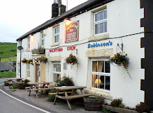
We decided to head back west to the little village of Sparrowpit where we'd previously driven past a pretty and whitewashed welcoming inn. 'The Wanted Inn' is located in a standalone position at the junction of 4 narrow roads - an ideal spot for weary and hungry travellers. It was early evening by the time we arrived, but as luck would have it, we bagged the last 2 Roasts! Apart from feeding our appetites, we also learned that 'The Wanted Inn' had a chequered history. It was built as a farmstead in 1618 by the Earl of Devonshire of Chatsworth House, on an ancient saltway route that ran from Cheshire to Sheffield, and the Vernon family were the tenants. In 1700 the farmstead became an Inn known as the 'Three Tuns' and the ancient packhorse route on which it stands became a turnpiked stage coach route. In 1839 the inn was renamed 'The Devonshire Arms' and was owned by the Duke, also Lord of the Manor - and the tenant (Joseph Vernon) became Inn Keeper. In 1888 an immense snow storm covered the Inn, and anyone wishing to get inside had to go through a tunnel 2-3 yards in length! When the 10th Duke died in 1950, his second son became heir, and because of massive death duties the Inn was put up for auction. However, it didn't get a bid and remained "unwanted". Finally in 1956 it was purchased, redesigned, restored ... and renamed 'The Wanted'!
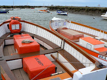
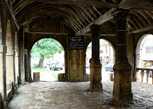
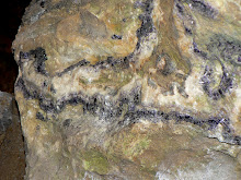
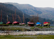
The final day of our stay in the Peak District began down a cavern! In an area honeycombed with pot holes and old lead mines, Castleton has four show caves open to the public in and around the town. We chose 'Blue John Mine', whose entrance lies just below the crumbling face of Mam Tor. The mine is part natural, part mine-workings, and contains natural chambers, veins of Blue John, fossils, stalactites and stalagmites. We descended deep into the mine down a long series of steps, and saw the Blue John veins which are still being mined today.
Blue John Stone is a rare, semi-precious mineral found at in Castleton's mines and no-where else in the world. The name Blue John derives from the French
Bleu Jaune meaning Blue Yellow. It is a form of fluorite and was discovered as miners were exploring the cave systems of Castleton for lead. Skilled craftsmen have in the past turned the larger stones into ornamental objects, some of which can still be seen in Chatsworth House. These days with fewer skilled craftsmen and sadly depleted reserves, most of the Blue John is turned into items of jewellery. But Blue John Stone has also given Castleton its nickname of 'Gem of the Peaks'.
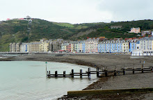
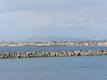
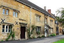
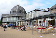
Castleton had certainly become our 'Gem of the Peaks' in 3 short days, but sadly it was time to leave this gem of a place, and to move southwards, on a scenic route homewards. Our first stop en route was in Buxton, in the High Peak of Derbyshire. Buxton sits in a bowl at about one thousand feet above sea level surrounded by mountains, and is itself a mountain spa. We didn't bathe their, nor drank the mineral water, but the coffee was good! Preferring rural to urban landscape, we moved on to one of Derbyshire's prettiest villages, Ashford in Water.
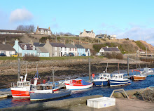
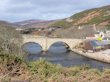
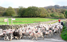
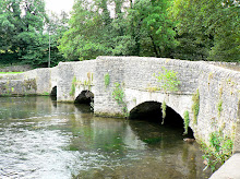
Ashford's main attraction is the Sheep wash bridge which spans the River Wye, and which is both picturesque and ancient. It was originally a medieval packhorse bridge, and only recently the practice of sheep-washing prior to shearing has stopped. The lambs would be penned within the stone-walled pen on one side of the river, whilst the mothers would be thrown in at the other side. They would naturally swim across to their offspring thus ensuring a good soaking!
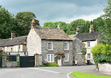
But other ancient customs, traditions and industries of Ashford are still in evidence today. Candle-making, garland-hanging, well-dressing and fashioning the local black marble is still part of everyday life in Ashford. This picture perfect village appears to have stood still in time - from it's medieval packhorse bridge, 13th century church, 18th century Ashford Hall and village bandstand to the charming chocolate box cottages which line its lanes. Last but not least, it has the most delightful delicatessen, tiny but crammed from floor to ceiling with every edible taste experience imaginable! That was lunch sorted ... !
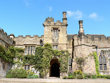
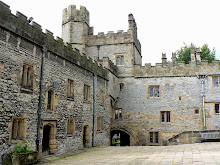
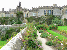
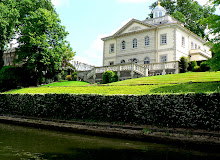
Our last stop of our last day was an unplanned and impromptu stop at a stately home - not Chatsworth, but Haddon Hall. Haddon Hall is a fortified medieval manor house, and is the home of Lord and Lady Edward Manners whose family have owned it since 1567. Described by Simon Jenkins in
1000 Best houses as "the most perfect house to survive from the middle ages", this remarkable old house is surrounded by terraced Elizabethan gardens and is set amongst the rolling countryside of the Peak District National Park. Present day Haddon Hall dates from the 12th Century to the early 17th Century, when it lay dormant for over two hundred years from 1700 until the 1920s, when the 9th Duke and Duchess of Rutland restored the house and gardens, and once again made it habitable. Managing to avoid fire, warfare, family misfortune and changing fashions, little has changed over the recent centuries and Haddon provides a unique view of early English life and history.
The manor of Haddon was originally in the hands of the Peveril family (just after the Norman Conquest), but was forfeited to the Crown in 1153. It then passed to a tenant of the Peverils, William Avenal, and was acquired in 1170 by Richard Vernon, who had married Avenal's daughter. The Vernons were responsible for most of the buildings at Haddon Hall, apart from the Peveril Tower and part of the Chapel, which were already there in 1170 (The same Vernons of 'Wanted Inn' no doubt!). The Long Gallery is the only significant part which was added later. In 1558 the heir to the manor, Dorothy Vernon, married (or as local legend says - eloped with) John Manners and the Hall has been in the hands of the Manners family ever since. It's interesting to note that the Hall has never been bought or sold.
The Manners family became the Earls, later Dukes, of Rutland and they moved their main seat to Belvoir Castle, using the hall very little in the 18th and 19th centuries. The result was that it was almost unaltered since the end of the 16th century when the 9th Duke realised its importance and began restoration after moving there in 1912.
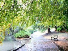
The house is in a beautiful situation and is very well preserved - even down to kitchens straight from the 17th century. The entrance courtyard still looks perfectly medieval, with gargoyles and crenelated walls. To the right hand side of the courtyard lies the Hall chapel, which looks much as it did in medieval times, and contains a beautiful carved alabaster retablo and pre-Reformation frescos which have been revealed from beneath the whitewash which hid them for centuries.
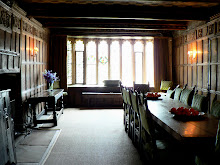
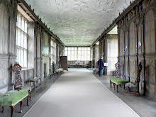
Entering the main house you soon come to the highlight of the visit - a glorious 14th Century Banqueting Hall complete with minstrels' gallery, which looks exactly as it must have done 600 years ago. ext door there is the Dining Room - a fine oak paneled room with minature portraits of Henry VII and his Queen. Beyond this lies a Tudor period Long Gallery, constructed around 1600. From the steps at the end of the Gallery Dorothy Vernon is said to have eloped with her lover, John Manners in 1558. These steps lead out into the gardens and down to the River Wye.
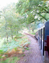
It was time for us to elope, back to our home town. But a return is planned ... to follow in the footsteps of the 1932 'Mass Tresspassers' up to Kinder Scout (636m), to travel on a steam train across the Monsal Dale viaduct, to visit Arkwright Mill at Cromford, the world’s first successful water powered cotton spinning mill ... and so much more!