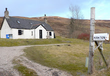
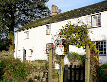
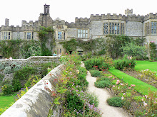
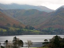
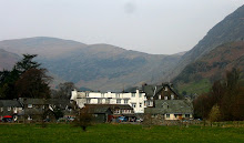
After a previous visit to Wastwater had captured my imagination and more than a little of my heart, a return visit to West Cumbria was always going to happen. We found accommodation in a delightful little farmhouse cottage in the Eskdale Valley, once owned by Beatrix Potter, now maintained by the National Trust and very soon to be our perfectly located base for a week in the peaceful and picturesque Eskdale Valley.
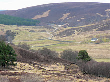
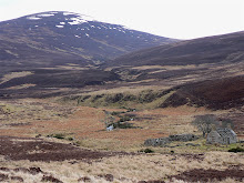
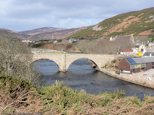
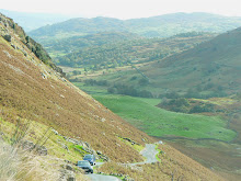
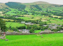
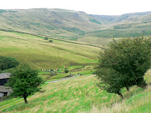
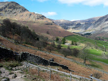
Penny Hill Farm, and indeed the Eskdale Valley, is in a remote and rather inaccessible part of Cumbria, hence the reason why it's so natural, unspoilt and therefore our number one choice for a walking holiday location. Just one narrow road feeds this pretty little valley. The A595 skirts the west Cumbrian coastline, threads its way eastwards through Eskdale, and winds steeply, sharply and alarmingly vertically out of the valley towards the central and eastern regions of the Lake District (more of that later!).
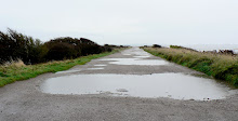
Our arrival at Penny Hill Farm took several hours longer than anticipated, due to invisible bridge repairs on the motorway, lengthy traffic hold ups and the necessary longer route round south Cumbria to reach our remote destination. But any frustrations or tiredness vanished as the scenery changed; dual carriageways were soon replaced by twisting leafy lanes and distant concrete conurbations by towering mountain peaks. A missed turning near our destination added a new and unintended dimension, as our route twisted upwards and around one of the towering peaks, before eventually levelling out across miles of misty moorland, with the daylight hours fast fading. Instead of driving around the bottom of the fell to reach Eskdale, we had driven over the top of it, adding time, tension, fear and an exciting white knuckle ride to the journey! But on finally reaching the narrow and leafy A595 in Eskdale Valley we soon found Penny Hill Farm - at the bottom of an even narrower single-track lane, across a tiny, ancient packhorse bridge over the babbling River Esk, and along a long and deeply pot-holed farm track!
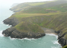
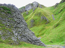
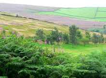
The next morning the sun was shining and we didn't waste any time in donning our boots and embarking on our first walk - up Green Crag Fell (1604'), opposite the farm. Having googled the route in advance, it promised to be a good 'first climb' for the week. But in true lakeland style, we were forced back down by a belt of extreme weather, relentless driving rain and strong buffeting winds which completely obliterated any chance of views over the valley. But again, in true lakeland style, the grey wet and windy weather turned to sunshine and within an hour or so we were back out, this time exploring everything the Eskdale valley had to offer, which turned out to be quite a lot!
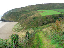
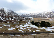
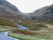
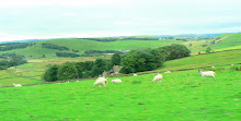
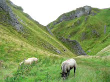
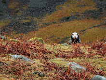
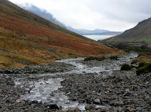
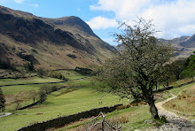
Several picturesque hours, miles and stream crossings later we arrived at the pretty 'Jubilee Bridge' at the eastern end of the Eskdale Valley, and the southern end of the infamous Hardknott Pass. After a picnic shared with some locals (picturesquedale sheep) we followed the River Esk through the Upper Eskdale Valley, adding 5 miles of stunning walking, over stiles, past boulders, through boggy marshland, at the foot of gills and waterfalls, beneath crags, across an ancient packhorse bridge and underneath the giant shadows of Bow Fell and Scafell, to name but two.
After the windy and wet conditions we'd walked in earlier, the weather in the Upper Eskdale Valley was a magical mix of bright sunshine, intermittent light showers with dramatic dark clouds, some spectacular lighting - and a rainbow! This was an unplanned and unexpectedly delightful walk, which remains one of our favourite in Eskdale. And so we ended our first day exhausted, enlightened, exhilerated and wondering if the next day could match it.
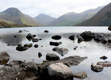
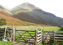
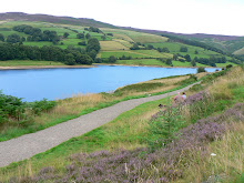
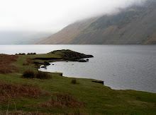
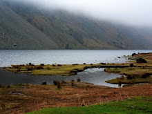
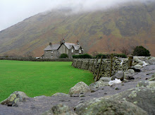
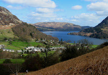
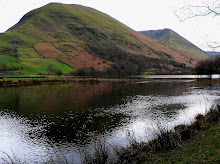
Our plans for the next day couldn't fail to match up! We'd decided to return to Wastwater again ... having left a part of me there last time we visited. The adrenalin was already flowing as we approached the village of Wasdale on the outskirts and saw in the distance the unmistakable silhouette of the mountain peaks that encircle this most lovely of all the Lakes (in my opinion). All expectations were surpassed. We sat for a while on the shores of Wastwater, re-familiarising ourselves with what is undeniably 'Britain's best view', and all the component parts that make it so - the dramatic scree slopes of Illgill Head, Whin Rigg, Scafell and Lingmell beyond, and on the other side Yewbarrow, Kirkfell and the imposing Great Gable and Little Gable. But there was time for further reflection later in the day, so we headed off to Wasdale Head to park the car, get booted up and start our 2nd exploratory walk of the week.
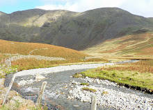
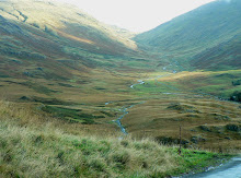
Turning off behind the Wasdale Head Inn, we followed a path between Yewbarrow and Kirkfell, and soon found ourselves in yet another stunning and undiscovered location (by us) - the Mosedale Valley. The weather was on our side, and provided a 'moving' light show as the sun clothed the mountain sides with intermittent golden light and shade. And as we followed the course of the Mosedale Beck, each twist and turn took us deeper into the valley and exposed yet more breathtaking aspects of Yewbarrow, Kirkfell, Pillar and Steeple ahead ... and what's more, we had it all to ourselves!
Two hours on we arrived back at Wasdale Head ready for our picnic beside Wastwater lake, and also eager to spend some more time gazing at the awesome backdrop. By now the sun was shining, adding a range of blue and purple hues to sky, water and mountains, which of course invoked a completely new set of photographs! Attempts to capture and retain digital images of the magic and majesty of Wastwater were made with the best of intentions, but you really do have to be there to experience it first hand. We finally reluctantly moved on, as there was another section of Wasdale that was beckoning ... .
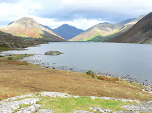
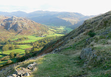
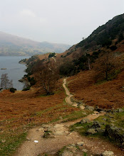
With only two or three hours of daylight ahead of us, we set off up Lingmell, a modest fell (2649') but one in the shadow of a much grander summit, the heady heights of the Scafell range (3206')! Any expectations we might have had about reaching Scafell summit were unrealistic, but at least we were on the route! The curved path hugging the contours of Lingmell are well trodden, and provide almost 360 degree views over Cumbria - south-eastwards to Wastwater and beyond it to the coast; north-eastwards across to Mosedale Valley; and westwards to Scafell Pike drawing us ever upwards like moths to a flame. As we climbed, so the views expanded and improved, and all the while Scafell summit was visible and tantalisingly achievable. Fortunately common sense and a realistic sense of distance versus time prevailed, and we made our way back down Lingmell, vowing that next time ... maybe later in the week ... we'd make the summit.
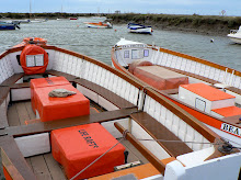
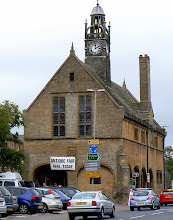
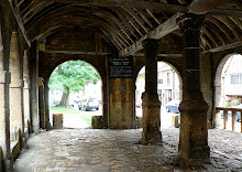
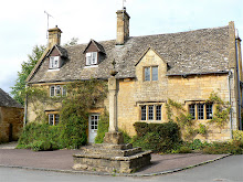
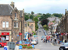
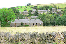
The following day we decided we should support the local tourist attraction and check out the much acclaimed Ravenglass and Eskdale Railway. Dalegarth Station was only a mile or two down the lane, and after purchasing our tickets we had time for a brief walk into the pretty hamlet of Boot in the very heart of Eskdale, huddled in the lea of Scafell and other high peaks. For such a tiny place Boot has much to offer - a historic corn mill which is allegedly the oldest working one in the country, quaint stone cottages, quite stunning scenery in an area described by Wainwright as 'a walker's paradise', two pretty pubs, three very friendly village cats, and last but not least one tiny craft shop selling "Art, Crafts and Really nice things' - yes really nice things, which we later purchased!
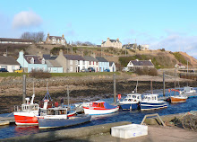
Back at Dalegarth Station we were soon aboard the little steam railway in an open carriage, chuffing our way along the narrow gauge track, on our 7 mile scenic adventure to Ravenglass. It was quite a chilly day and we wondered if the open carriage choice had been the most sensible one, but with the prospect of a new coastal venue to explore at the end of the line, we stuck with it and enjoyed the ride anyway. Once at our destination we disembarked, and headed off towards what seemed to be the town of Ravenglass. Our first priority was to find a cafe and order a mug of hot coffee to thaw ourselves out. Our second was to spend the afternoon exploring Ravenglass. We didn't actually achieve either!
Ravenglass is very small, and when out of season it is also very shut! We wondered down the High Street (or rather, the only street) but couldn't find anywhere open. At the far end of the street we did find the sea though - between 2 houses, at the bottom of a concrete causeway. No sign of a beach, promenade or walkway though, so we turned on our heels and headed straight back to Ravenglass Station, where we found 'The Ratty Arms.' This was a pub/converted railway carriage, and looked hopeful. Once inside, 'The Tatty Arms' seemed a more appropriate name, but we ordered anyway as it was lunchtime and we were frozen. I wasn't that hungry as I'd been developing severe indigestion all morning, but a jacket potato sounded just enough. When it arrived it was more than enough - suffice to say, if 'The Tatty Arms' invested as much in refurbishment as it clearly does in maintaining it's gigantuous portion sizes, it would be the most up-market pub in Cumbria!
As luck would have it the weather took a huge turn for the better when we arrived back in Dalegarth, and so we embarked on phase two of the day's itinerary - a short, steep but pretty walk from Boot up to Eel Tarn and back. Unfortunately my 'indigestive system' had other plans, so we had to cut the walk short and return to Penny Hill Farm for some rest and recovery - but vowing to complete the walk before the week was through. After a couple of hours the R&R had worked and we enjoyed a leafy autumnal walk alongside the River Esk, in the shadow of Birker Fell.
The next morning we were woken by the wind rattling the windows and heavy rain pounding on the panes. As there was no improvement by breakfast, not the slightest hint of any before midday, nor any hope of visibility for views, we decided to have a day in the car, exploring the coastline. It sounded like a good plan.
Grange-over-Sands sounded like a good place to start, an established seaside town which would no doubt have plenty to keep tourists occupied on a wet and windy day. Now, I've absolutely no doubt that Grange-over-Sands in high season is as picturesque as Victorian seaside resorts come. It had a quaint railway station on the promenade, plenty of Victoriana charm adorning it's buildings, grand terraced ornamental gardens, a wildfowl collection any reserve would be proud of ... but there was no beach, no sea, just miles of mudflats stretching to the horizon ... made even less appealing by the relentless driving rain. Thankfully 'Butterfingers' came to our rescue with hot coffee, cream scones and refuge from the rain! Perhaps Barrow-in-Furness would have a beach.
As we approached Barrow we spotted what appeared to be an inhabited island sitting in the middle of the sea. As we got closer we could see a road had been built in the sea providing access to the island, so looking for a bit of excitement on an otherwise drab and dreary day, we drove 'across the sea' onto Roa Island. We parked. We looked for excitement. We drove back onto the mainland!
The next stop was Walney Island, a place I'd visited briefly with some good friends from Barrow in the early 80's. My memories from that occasion were of camping on sand dunes for the night, looking up at a clear, unpolluted and star studded sky, watching satellites and shooting stars for the first time. Clearly we weren't seeing Walney at it's best this time. The island is a strange shaped promentary off the Furness coast, 11 miles long and less than a mile wide, apparently with a population of some 13000, though I'd be exaggerating if I said we saw more than 13 of them. We stayed only briefly, as even the wildfowl on the nature reserve appeared to have migrated somewhere drier and warmer! But bad weather apart, we still hadn't found our seaside resort.
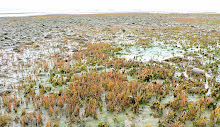
Hugging the coastline as we wended our wet and weary way back towards Cumbria we still hadn't given up hope of a walk along that elusive beach with some sea views. According to the map, there was a nature reserve at Millom on the coast which looked hopeful. But after driving down numerous pot-holed lanes, all we found was a prison, and a huge caravan park (some would say the two are synonymous), but eventually we stumbled on Haverigg, and a beach (of sorts). Determined to tough out the weather (yes, it was still raining 5 hours on), we ventured onto the beach to check out the curious colourful plants which seemed to be thriving in the salt water! Then we noticed a long curved causeway leading to a lighthouse ... and maybe to the reserve? After an hour battling with horizontal rain, deep puddles, gale force gusts and a distinct lack of views, we checked out the lighthouse ... before retracing our steps, no longer interested in beaches, sea or anything else of a wet nature!
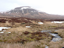
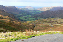
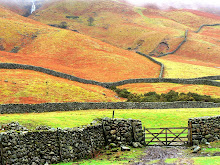
So the next day it was back to walking, mountains, and summits! We decided to climb up Birker Fell once again, but this time to attempt the Green Crag summit. The conditions were perfect, our muscles were aching to get moving again, the sun was shining in a blue sky, visibility couldn't be better and we couldn't wait to get started. We began our walk from Penny Hill Farm, but this time headed for the famous Doctor Bridge, turning and keeping left by the River Esk for the gradual climb up Low Birker Fell. The track followed the old 'peat road' - the farmers of Eskdale once extracted peat from the plateau and the remains of graded paths and granite 'peat drying' huts can still be found on the fellside. With clear, colourful and commanding views across the whole length of the Eskdale Valley, it was difficult to choose between stopping to take photographs and forging ahead to our destination, but the old peat road soon became rough underfoot, narrowed considerably and wound steeply, hugging the edge of the fell as it zig-zagged it's way up to the boggy basin of Foxbield Moss.
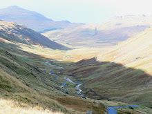
Several miles, streams and boggy-crossings further on, the path continued to wind and climb past Low Birker Tarn, beneath huge rocky crags, through bracken, in the shadow of the Great Whinscale ridge and around the conical Pike, until Green Crag at last came into view.
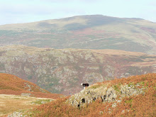
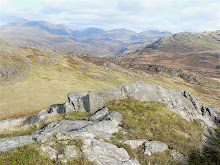
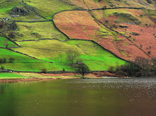
There was no doubt in my mind that we would climb to the summit, but the closer we got to Green Crag, the further away it seemed! The narrow boggy path wound steadily upwards to a cairn which marks the start of the ascent to the summit - we somehow managed to miss this, but found our own way without too much trouble. After picking our way around rocky debris, a short, sharp and steep grassy climb and a final scrabble up the last scree slope we made it to the summit. For a relatively small 'nursery peak' at just 1604', the view was pretty impressive! From left to right we could see all the giants that encircle the Wasdale/Eskdale valleys - Illgill Head, Whin Rigg, Scafell Pike, Crinkle Crags and Bowfell. The colours were stunning, the natural blues and mauves of mountains provided a backdrop to the autumn palette of pale browns, ochre, greens and rusts of Birker Fell around us.
After capturing as much of this amazing 360 degree panorama on camera as was possible, and enjoying our 'sarnies at the summit' we reluctantly left this little piece of heaven for the next walker to elate and exuberate over, and retraced our steps down Birker Fell, back to the River Esk.
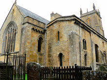
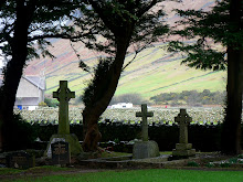
Once back down, there was no stopping us ... with reserves of energy and sunshine levels still high we decided to extend the walk across the Eskdale Valley and up the other side ... from Boot to Eel Tarn (ie the other walk we had aborted earlier in the week). Our extended walk took us past St Catherine's Church, thought to date from 1125. It is believed that the church was named by William le Meschines, who founded the Priory of St Bees plus four chapels, one of which was named after the Patron Saint of soldiers, St Catherine. I had wanted to find it simply because it's also my name, and because we'd been unable to located it on two previous walks in the vicinity previously! So having located it, walked round it, gone in it and photographed it, we followed a few more ancient tracks across the valley to Boot, where some liquid refreshment and unexpected entertainment was to be had!
Brook House Inn was known to us, as we'd read about another 'Sheena' who had frequented it, as part of her own walking holiday in Eskdale! Photographs of my eponymous fellow trekker taking some liquid refreshment outside the Brook House Inn can be found on her website, where there is also an account of her trek up Green Crag. Not being used to sharing my name with many people, I'd like to thank 'Sheena' for the amusing anecdote to our time in Eskdale, and for her route, photos and tips on the area! But 'Sheep' as well as 'Sheena' provided entertainment at the Brook House Inn crossroads.
As we sat outside in the autumn sun enjoying the tranquility of rural life, the peaceful scene was broken by the barking of sheep dogs and baa-ing of sheep, as a farmer tried to manouevre his frantic and frenetic flock from their field down the lane opposite us, across the road, and down the side of Brook House Inn to the farm. The farmer himself was frantically trying to avoid the sheep being freaked out by sudden noises from people or traffic movement, and told his own sheepish anecdote of a previous occasion when 'tourists' had caused serious delays to this simple manouevre by noisily climbing on the roof of their vehicle to get good 'sheep in action' pictures. We took heed of his salutory tale and stood stock still with our cameras. I guess maybe the sheep in Eskdale aren't as streetwise or tourist savvy as their East Cumbrian cousins!
Following the herd, we walked down the lane into Boot to start our upward climb to Eel Tarn. Whilst the conditions weren't quite as perfect as our first attempt at this walk, it was fair and fine, and without trace of indigestion this time around! Eel Tarn is Eskdale's most accessible tarn and gives a good insight into the high moors without having to stride out across the tussocky slopes or navigate a route through a maze of sphagnum moss hummocks. The word 'eel' is said to mean evil, alluding to will-o'-the-wisp marsh gas leading travellers astray. The tarn lies on one of the few grassy saddles in the castellated rock rim that borders this side of Burnmoor. It's a placid tarn which in winter reflects the open skies, and in summer is covered in White Water Lilies, with the dark blue angles of Harter Fell's bold crags as a backdrop. To the north and east, the landscape is in complete contrast, opening out on to breeze-rippled moors and the gentle, flowing forms of Boat How, Illgill Head. And beyond, the great Scafell Pike making it's presence felt from every angle.
We continued past Eel Tarn, curving round and down Burnmoor fell ending our walk at The Woolpack Inn, just a stone's throw from Penny Hill Farm. As we approached the farm, the sun was setting, casting a golden glow on Harter Fell, the valley, and our cottage. A perfect end to a long and lovely day.
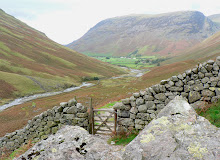
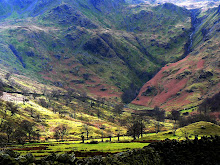
Our last full day in The Lakes had arrived, and whilst there was still plenty to see and do within the Eskdale/Wasdale regions, we wanted to take the opportunity to see more of Cumbria before we left. We also wanted to check out the Roman Fort that holds commanding views over Eskdale Valley ... but access to both was up the Hardknott Pass, the steepest road in Britain. The photos I'd seen online looked impressive, and the route exciting but fairly benign. The notice we'd seen at the bottom of the pass looked a little less impressive, it read, 'Road suitable for cars and light vehicles only 4 miles ahead. Unsuitable for all vehicles in winter weather'. Well, it was still Autumn, just, and the route would provide much quicker access to the Langdale Pikes, Derwent Water, Crummock & Buttermere and the other 'must sees' on our itinerary. The weather was cold but dry, our car was pretty robust and the driver experienced. Unfortunately the passenger (aka me) was of a nervous (soon to be petrified) disposition!
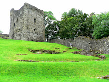
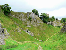
We left the valley and started our ascent. The first of the 12 hairpin bends was reasonable, and after a few more we pulled over into a small designated parking area to explore the Hardknott Fort ruins, 800' above sea level, and providing the opportunity for panoramic shots of the Eskdale Valley that we wouldn't otherwise have seen. The fort was most likely built in the early 2nd century to command the pass from Ambleside to the Roman fort and port at Ravenglass. It stands in such a strategic position that it would have been difficult for marauding locals to spring a surpise attack. History aside, the site certainly offered impressive views of the Eskdale and Upper Eskdale Valleys, both of which we were now quite familiar!
Back on the hairpin route once more, the crazy 1:3 (33%) gradient and razor sharp zig-zags rose alarmingly above us, or as one cyclist put it, "the road ahead rears up like a startled stallion." But we tried so very hard to ignore the burnt tyre marks scorched onto the tarmac, and instead remained focused on the salient fact that the higher we climbed, the narrower the road became and therefore the decrease in passing places!
The inevitable happened. A car approached us from 'above', zig-zagging it's way down the now single track road towards us. We had 3 clear options. To pull over onto the precipice, to reverse backwards down a perilously steep section towards a passing place, or to force the other car to reverse vertically up the road to 1289' above us. The first option would probably have sent shock waves down the valley with my screams; the second would have quietened me, as I would have blacked out, and the third just wasn't physically/mechanically possible for the passing car as it wasn't a 4-wheel drive. So we stopped, we rolled back a little way, we let the car pass, we tried to move forward, we left a few tyre imprints behind, and we continued with gritted teeth and clenched muscles, hoping against hope that we were over the worst bit.
Now whilst we didn't have any further major encounters with on-coming vehicles, the tension didn't lift for some 3.5 miles. This is the total length of the 2 passes and the Duddon Valley, which when combined provide one long spectacular white knuckle ride, giving adrenalin junkies their kicks, and giving worry junkies like me their worst nightmares. Somehow we made it to the top and as we drove between Hardknott and Harter Fells, there was another set of obstacles laid out before us. I must at this point apologise for the lack of spectacular photos as we approached the top of Hardknott Pass, but you will appreciate it's difficult to operate a camera when your fingers are tightly clenched and regular breathing is put on hold!
However, the views down Duddon Valley were duly noted, but silently. I was in survival mode, and was reserving all vocal chord energies for potential emergencies, or until the white knuckle ride had ended safely! We wouldn't be returning via this route, that was for sure!
But as with any good retrospective story, it was a truly memorable, if not repeatable experience, and the dramatic landscape over the pass and through the Duddon Valley were well worth the trauma. And, of course, we were soon driving around the pretty country lanes in Langdale ... still speechless and traumatised you'll understand ... but looking forward to some strong coffee in Ambleside!
The transition from 'trembling' to 'giggling' was made possible courtesy of a charming Coffee House called 'The Giggling Goose'! This delightful place was part of The Old Mill House in North Ambleside, and came complete with working water wheel, babbling stream from Rydal Water, a tree-lined walkway, outside eating area, and it's own tame Robin. Oh, and the huge homemade scones and fresh coffee come highly recommended too!
After a quick forage in 'Blacks' for some new walking socks, and the obligatory hunt for a fridge magnet depicting Wastwater (no tourist shops in Wasdale!), we set off towards Derwent Water, and more specifically, Ashness Bridge.
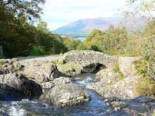
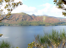
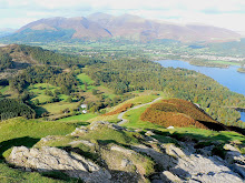
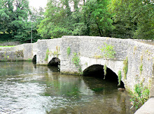
Said to have graced more calendars than many other Lake District views, Ashness Bridge is a perfect example of a traditionally built stone packhorse bridge, and provides an even more perfect foreground to the superb views of Derwentwater and the peaks of Skiddaw and Blencathra beyond. As we were there 'out of season' we had this picture perfect view largely to ourselves - with the exception of the elderly lady in a bright red cardigan who innocently sat down on her picnic rug next to the bridge and enjoyed her sandwiches, who seemed not to notice or wonder why various camera lenses were pointed in her direction!
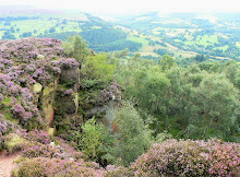
We moved on to Ashness Wood and followed the scenic footpath to a cliff edge point known as Surprise View. From this vantage point there were more stunning views over Derwentwater, but what captured my attention in particular was the fell on the other side, and people walking up it. Thanks to Julia Bradbury, we were familiar with the climb up Cat Bells after 'walking it with her' one evening on BBC2 TV! As we had a list of 'possible walks' on the itinerary for the day, Cat Bells seemed an ideal choice, so we left Ashness Bridge and found our way to the base of our next challenge.
There appeared to be 2 main routes up Cat Bells. We chose the most vertical one, simply because we chose the wrong one! However, climbing up the sheerer grassy face of the fell had it's advantages - it was a more direct route to the summit, and it was also probably quicker, even taking my many stops into consideration. Once on the main 'saddle' of the fell, we headed off towards the summit, which seemed altogether higher and further away, the closer we got to it!
As grass gave way to chalky boulders, and the gradient significantly increased, it became clear that the next stage of the ascent required hands as well as feet, a good steady balance, and a strong head for heights! With Wainwright's words ringing in my ears, "Catbells is ... a family fell where grandmothers and infants can climb the heights together," I scrambled onwards and upwards, but at this point felt unable to stand up without losing my balance, let alone climb the remaining section. The final push to the summit was still some way off, but I could see the route not only steepened, but narrowed considerably. Being practical and basing my judgement on the premise that 'discretion is the better part of valour', I decided that to continue would be foolish for me. Wainwright clearly didn't have a problem staying upright at height!
Feelings of disappointment and frustration at my own shortcomings were fairly shortlived and soon gave way to exclamations of amazement at the spectacular panorama of fells, lakes and valleys which stretched out before us like an oil painting on a giant canvas. We chose the descent which took us along the spine of Cat Bells, a route that was not without a few obstacles, but one which gave us maximum exposure to the magnificent scenery and photo opportunities around us. By the time we got back to the car it was late afternoon, but with one last 'must see' on the itinerary and only an hour or two of daylight left, we needed to move fast.
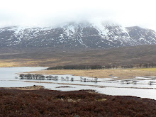
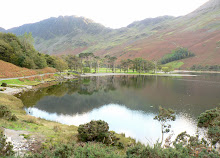
The last section of our journey entailed driving north, then west, to Buttermere and Crummock and thereby completing the penultimate section of our 'circular tour' around the more remote and therefore less touristy Western/Central Lakes. What I hadn't fully appreciated was just how remote Buttermere and Crummock are in terms of access. As the crow flies Buttermere is probably only 10 miles or so due North of Wastwater, but with restricted access, time and fading light against us, we only had 1 option open to us - to drive on yet another Mountain Pass
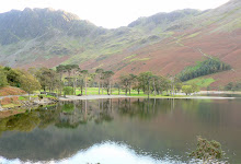
Whinlatter Pass forms part of a very scenic, but steep and twisting section of the B5262. It winds its way througb Thornthwaite Forest, 1042' above sea level, and is flanked by a number of impressive fells, one of which is Grisedale Pike. Hence the journey was slowly and carefully undertaken. Once at Buttermere we headed straight towards our objective - I wanted to see first hand the much photographed view of the 'Buttermere Pines' and their reflections in the southern edge of the lake, and of course to take some of my own. With the famous craggy peaks of Haystacks towering 1959' above us, this was an unexpectedly awesome view and one I was sorry to leave so quickly, but not before making a mental note to return to this idyllic spot in the future, and what's more, to see it from the top of Haystacks!
With nearly 30 miles still ahead of us and with darkness quickly falling, we beat a hasty retreat back, past Loweswater, eventually finding the A5086 south, at last picking up the A595 and finally along a myriad of single track roads which snaked their way back into the Western Lakes region and to the Eskdale Valley.
We couldn't leave the Western Lakes without one last visit to Wastwater. So after fond farewells to our cottage, to Penny Hill Farm. the chickens, the 3 sheepdogs, the cat, and the beautiful Eskdale Valley we set off down the now familiar 12 mile scenic route into Wasdale for one last look and maybe a walk. There wasn't time to see more of Mosedale, Scafell, Illgill Head or any of the other grand fells lining Wastwater, so instead we went to the head of the lake to the pyramid shaped peak that lies at the centre of 'Britain's favourite view'.
Great Gable had several route options to it's 2300' summit from Wasdale Head, so choosing the most accessible and gentle of these we tentatively decided to see how far we could climb in the time available to us. We walked for about an hour, had a picnic with a stunning view, but didn't achieve much in terms of height. However our walk was a gentle introduction to the imposing Great Gable, a great way to leave the Wasdale Valley and to end our lovely week in this remote and magical part of Cumbria! With Buttermere, Haystacks, Ennerdale and Scafell already on our 'must see next' list, we will be back ... !
Penny Hill Farm, and indeed the Eskdale Valley, is in a remote and rather inaccessible part of Cumbria, hence the reason why it's so natural, unspoilt and therefore our number one choice for a walking holiday location. Just one narrow road feeds this pretty little valley. The A595 skirts the west Cumbrian coastline, threads its way eastwards through Eskdale, and winds steeply, sharply and alarmingly vertically out of the valley towards the central and eastern regions of the Lake District (more of that later!).
Our arrival at Penny Hill Farm took several hours longer than anticipated, due to invisible bridge repairs on the motorway, lengthy traffic hold ups and the necessary longer route round south Cumbria to reach our remote destination. But any frustrations or tiredness vanished as the scenery changed; dual carriageways were soon replaced by twisting leafy lanes and distant concrete conurbations by towering mountain peaks. A missed turning near our destination added a new and unintended dimension, as our route twisted upwards and around one of the towering peaks, before eventually levelling out across miles of misty moorland, with the daylight hours fast fading. Instead of driving around the bottom of the fell to reach Eskdale, we had driven over the top of it, adding time, tension, fear and an exciting white knuckle ride to the journey! But on finally reaching the narrow and leafy A595 in Eskdale Valley we soon found Penny Hill Farm - at the bottom of an even narrower single-track lane, across a tiny, ancient packhorse bridge over the babbling River Esk, and along a long and deeply pot-holed farm track!
The next morning the sun was shining and we didn't waste any time in donning our boots and embarking on our first walk - up Green Crag Fell (1604'), opposite the farm. Having googled the route in advance, it promised to be a good 'first climb' for the week. But in true lakeland style, we were forced back down by a belt of extreme weather, relentless driving rain and strong buffeting winds which completely obliterated any chance of views over the valley. But again, in true lakeland style, the grey wet and windy weather turned to sunshine and within an hour or so we were back out, this time exploring everything the Eskdale valley had to offer, which turned out to be quite a lot!
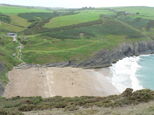
Several picturesque hours, miles and stream crossings later we arrived at the pretty 'Jubilee Bridge' at the eastern end of the Eskdale Valley, and the southern end of the infamous Hardknott Pass. After a picnic shared with some locals (picturesquedale sheep) we followed the River Esk through the Upper Eskdale Valley, adding 5 miles of stunning walking, over stiles, past boulders, through boggy marshland, at the foot of gills and waterfalls, beneath crags, across an ancient packhorse bridge and underneath the giant shadows of Bow Fell and Scafell, to name but two.
After the windy and wet conditions we'd walked in earlier, the weather in the Upper Eskdale Valley was a magical mix of bright sunshine, intermittent light showers with dramatic dark clouds, some spectacular lighting - and a rainbow! This was an unplanned and unexpectedly delightful walk, which remains one of our favourite in Eskdale. And so we ended our first day exhausted, enlightened, exhilerated and wondering if the next day could match it.
Our plans for the next day couldn't fail to match up! We'd decided to return to Wastwater again ... having left a part of me there last time we visited. The adrenalin was already flowing as we approached the village of Wasdale on the outskirts and saw in the distance the unmistakable silhouette of the mountain peaks that encircle this most lovely of all the Lakes (in my opinion). All expectations were surpassed. We sat for a while on the shores of Wastwater, re-familiarising ourselves with what is undeniably 'Britain's best view', and all the component parts that make it so - the dramatic scree slopes of Illgill Head, Whin Rigg, Scafell and Lingmell beyond, and on the other side Yewbarrow, Kirkfell and the imposing Great Gable and Little Gable. But there was time for further reflection later in the day, so we headed off to Wasdale Head to park the car, get booted up and start our 2nd exploratory walk of the week.
Turning off behind the Wasdale Head Inn, we followed a path between Yewbarrow and Kirkfell, and soon found ourselves in yet another stunning and undiscovered location (by us) - the Mosedale Valley. The weather was on our side, and provided a 'moving' light show as the sun clothed the mountain sides with intermittent golden light and shade. And as we followed the course of the Mosedale Beck, each twist and turn took us deeper into the valley and exposed yet more breathtaking aspects of Yewbarrow, Kirkfell, Pillar and Steeple ahead ... and what's more, we had it all to ourselves!
Two hours on we arrived back at Wasdale Head ready for our picnic beside Wastwater lake, and also eager to spend some more time gazing at the awesome backdrop. By now the sun was shining, adding a range of blue and purple hues to sky, water and mountains, which of course invoked a completely new set of photographs! Attempts to capture and retain digital images of the magic and majesty of Wastwater were made with the best of intentions, but you really do have to be there to experience it first hand. We finally reluctantly moved on, as there was another section of Wasdale that was beckoning ... .
With only two or three hours of daylight ahead of us, we set off up Lingmell, a modest fell (2649') but one in the shadow of a much grander summit, the heady heights of the Scafell range (3206')! Any expectations we might have had about reaching Scafell summit were unrealistic, but at least we were on the route! The curved path hugging the contours of Lingmell are well trodden, and provide almost 360 degree views over Cumbria - south-eastwards to Wastwater and beyond it to the coast; north-eastwards across to Mosedale Valley; and westwards to Scafell Pike drawing us ever upwards like moths to a flame. As we climbed, so the views expanded and improved, and all the while Scafell summit was visible and tantalisingly achievable. Fortunately common sense and a realistic sense of distance versus time prevailed, and we made our way back down Lingmell, vowing that next time ... maybe later in the week ... we'd make the summit.
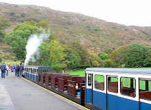
The following day we decided we should support the local tourist attraction and check out the much acclaimed Ravenglass and Eskdale Railway. Dalegarth Station was only a mile or two down the lane, and after purchasing our tickets we had time for a brief walk into the pretty hamlet of Boot in the very heart of Eskdale, huddled in the lea of Scafell and other high peaks. For such a tiny place Boot has much to offer - a historic corn mill which is allegedly the oldest working one in the country, quaint stone cottages, quite stunning scenery in an area described by Wainwright as 'a walker's paradise', two pretty pubs, three very friendly village cats, and last but not least one tiny craft shop selling "Art, Crafts and Really nice things' - yes really nice things, which we later purchased!
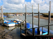
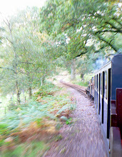
Back at Dalegarth Station we were soon aboard the little steam railway in an open carriage, chuffing our way along the narrow gauge track, on our 7 mile scenic adventure to Ravenglass. It was quite a chilly day and we wondered if the open carriage choice had been the most sensible one, but with the prospect of a new coastal venue to explore at the end of the line, we stuck with it and enjoyed the ride anyway. Once at our destination we disembarked, and headed off towards what seemed to be the town of Ravenglass. Our first priority was to find a cafe and order a mug of hot coffee to thaw ourselves out. Our second was to spend the afternoon exploring Ravenglass. We didn't actually achieve either!
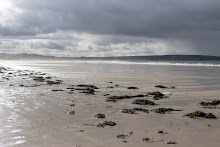
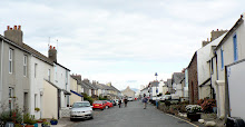
Ravenglass is very small, and when out of season it is also very shut! We wondered down the High Street (or rather, the only street) but couldn't find anywhere open. At the far end of the street we did find the sea though - between 2 houses, at the bottom of a concrete causeway. No sign of a beach, promenade or walkway though, so we turned on our heels and headed straight back to Ravenglass Station, where we found 'The Ratty Arms.' This was a pub/converted railway carriage, and looked hopeful. Once inside, 'The Tatty Arms' seemed a more appropriate name, but we ordered anyway as it was lunchtime and we were frozen. I wasn't that hungry as I'd been developing severe indigestion all morning, but a jacket potato sounded just enough. When it arrived it was more than enough - suffice to say, if 'The Tatty Arms' invested as much in refurbishment as it clearly does in maintaining it's gigantuous portion sizes, it would be the most up-market pub in Cumbria!
As luck would have it the weather took a huge turn for the better when we arrived back in Dalegarth, and so we embarked on phase two of the day's itinerary - a short, steep but pretty walk from Boot up to Eel Tarn and back. Unfortunately my 'indigestive system' had other plans, so we had to cut the walk short and return to Penny Hill Farm for some rest and recovery - but vowing to complete the walk before the week was through. After a couple of hours the R&R had worked and we enjoyed a leafy autumnal walk alongside the River Esk, in the shadow of Birker Fell.
The next morning we were woken by the wind rattling the windows and heavy rain pounding on the panes. As there was no improvement by breakfast, not the slightest hint of any before midday, nor any hope of visibility for views, we decided to have a day in the car, exploring the coastline. It sounded like a good plan.
Grange-over-Sands sounded like a good place to start, an established seaside town which would no doubt have plenty to keep tourists occupied on a wet and windy day. Now, I've absolutely no doubt that Grange-over-Sands in high season is as picturesque as Victorian seaside resorts come. It had a quaint railway station on the promenade, plenty of Victoriana charm adorning it's buildings, grand terraced ornamental gardens, a wildfowl collection any reserve would be proud of ... but there was no beach, no sea, just miles of mudflats stretching to the horizon ... made even less appealing by the relentless driving rain. Thankfully 'Butterfingers' came to our rescue with hot coffee, cream scones and refuge from the rain! Perhaps Barrow-in-Furness would have a beach.
As we approached Barrow we spotted what appeared to be an inhabited island sitting in the middle of the sea. As we got closer we could see a road had been built in the sea providing access to the island, so looking for a bit of excitement on an otherwise drab and dreary day, we drove 'across the sea' onto Roa Island. We parked. We looked for excitement. We drove back onto the mainland!
The next stop was Walney Island, a place I'd visited briefly with some good friends from Barrow in the early 80's. My memories from that occasion were of camping on sand dunes for the night, looking up at a clear, unpolluted and star studded sky, watching satellites and shooting stars for the first time. Clearly we weren't seeing Walney at it's best this time. The island is a strange shaped promentary off the Furness coast, 11 miles long and less than a mile wide, apparently with a population of some 13000, though I'd be exaggerating if I said we saw more than 13 of them. We stayed only briefly, as even the wildfowl on the nature reserve appeared to have migrated somewhere drier and warmer! But bad weather apart, we still hadn't found our seaside resort.
Hugging the coastline as we wended our wet and weary way back towards Cumbria we still hadn't given up hope of a walk along that elusive beach with some sea views. According to the map, there was a nature reserve at Millom on the coast which looked hopeful. But after driving down numerous pot-holed lanes, all we found was a prison, and a huge caravan park (some would say the two are synonymous), but eventually we stumbled on Haverigg, and a beach (of sorts). Determined to tough out the weather (yes, it was still raining 5 hours on), we ventured onto the beach to check out the curious colourful plants which seemed to be thriving in the salt water! Then we noticed a long curved causeway leading to a lighthouse ... and maybe to the reserve? After an hour battling with horizontal rain, deep puddles, gale force gusts and a distinct lack of views, we checked out the lighthouse ... before retracing our steps, no longer interested in beaches, sea or anything else of a wet nature!
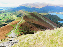
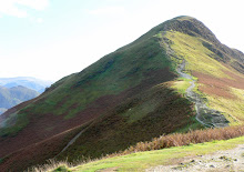
So the next day it was back to walking, mountains, and summits! We decided to climb up Birker Fell once again, but this time to attempt the Green Crag summit. The conditions were perfect, our muscles were aching to get moving again, the sun was shining in a blue sky, visibility couldn't be better and we couldn't wait to get started. We began our walk from Penny Hill Farm, but this time headed for the famous Doctor Bridge, turning and keeping left by the River Esk for the gradual climb up Low Birker Fell. The track followed the old 'peat road' - the farmers of Eskdale once extracted peat from the plateau and the remains of graded paths and granite 'peat drying' huts can still be found on the fellside. With clear, colourful and commanding views across the whole length of the Eskdale Valley, it was difficult to choose between stopping to take photographs and forging ahead to our destination, but the old peat road soon became rough underfoot, narrowed considerably and wound steeply, hugging the edge of the fell as it zig-zagged it's way up to the boggy basin of Foxbield Moss.
Several miles, streams and boggy-crossings further on, the path continued to wind and climb past Low Birker Tarn, beneath huge rocky crags, through bracken, in the shadow of the Great Whinscale ridge and around the conical Pike, until Green Crag at last came into view.
There was no doubt in my mind that we would climb to the summit, but the closer we got to Green Crag, the further away it seemed! The narrow boggy path wound steadily upwards to a cairn which marks the start of the ascent to the summit - we somehow managed to miss this, but found our own way without too much trouble. After picking our way around rocky debris, a short, sharp and steep grassy climb and a final scrabble up the last scree slope we made it to the summit. For a relatively small 'nursery peak' at just 1604', the view was pretty impressive! From left to right we could see all the giants that encircle the Wasdale/Eskdale valleys - Illgill Head, Whin Rigg, Scafell Pike, Crinkle Crags and Bowfell. The colours were stunning, the natural blues and mauves of mountains provided a backdrop to the autumn palette of pale browns, ochre, greens and rusts of Birker Fell around us.
After capturing as much of this amazing 360 degree panorama on camera as was possible, and enjoying our 'sarnies at the summit' we reluctantly left this little piece of heaven for the next walker to elate and exuberate over, and retraced our steps down Birker Fell, back to the River Esk.
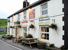
Once back down, there was no stopping us ... with reserves of energy and sunshine levels still high we decided to extend the walk across the Eskdale Valley and up the other side ... from Boot to Eel Tarn (ie the other walk we had aborted earlier in the week). Our extended walk took us past St Catherine's Church, thought to date from 1125. It is believed that the church was named by William le Meschines, who founded the Priory of St Bees plus four chapels, one of which was named after the Patron Saint of soldiers, St Catherine. I had wanted to find it simply because it's also my name, and because we'd been unable to located it on two previous walks in the vicinity previously! So having located it, walked round it, gone in it and photographed it, we followed a few more ancient tracks across the valley to Boot, where some liquid refreshment and unexpected entertainment was to be had!
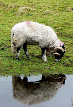
Brook House Inn was known to us, as we'd read about another 'Sheena' who had frequented it, as part of her own walking holiday in Eskdale! Photographs of my eponymous fellow trekker taking some liquid refreshment outside the Brook House Inn can be found on her website, where there is also an account of her trek up Green Crag. Not being used to sharing my name with many people, I'd like to thank 'Sheena' for the amusing anecdote to our time in Eskdale, and for her route, photos and tips on the area! But 'Sheep' as well as 'Sheena' provided entertainment at the Brook House Inn crossroads.
As we sat outside in the autumn sun enjoying the tranquility of rural life, the peaceful scene was broken by the barking of sheep dogs and baa-ing of sheep, as a farmer tried to manouevre his frantic and frenetic flock from their field down the lane opposite us, across the road, and down the side of Brook House Inn to the farm. The farmer himself was frantically trying to avoid the sheep being freaked out by sudden noises from people or traffic movement, and told his own sheepish anecdote of a previous occasion when 'tourists' had caused serious delays to this simple manouevre by noisily climbing on the roof of their vehicle to get good 'sheep in action' pictures. We took heed of his salutory tale and stood stock still with our cameras. I guess maybe the sheep in Eskdale aren't as streetwise or tourist savvy as their East Cumbrian cousins!
Following the herd, we walked down the lane into Boot to start our upward climb to Eel Tarn. Whilst the conditions weren't quite as perfect as our first attempt at this walk, it was fair and fine, and without trace of indigestion this time around! Eel Tarn is Eskdale's most accessible tarn and gives a good insight into the high moors without having to stride out across the tussocky slopes or navigate a route through a maze of sphagnum moss hummocks. The word 'eel' is said to mean evil, alluding to will-o'-the-wisp marsh gas leading travellers astray. The tarn lies on one of the few grassy saddles in the castellated rock rim that borders this side of Burnmoor. It's a placid tarn which in winter reflects the open skies, and in summer is covered in White Water Lilies, with the dark blue angles of Harter Fell's bold crags as a backdrop. To the north and east, the landscape is in complete contrast, opening out on to breeze-rippled moors and the gentle, flowing forms of Boat How, Illgill Head. And beyond, the great Scafell Pike making it's presence felt from every angle.
We continued past Eel Tarn, curving round and down Burnmoor fell ending our walk at The Woolpack Inn, just a stone's throw from Penny Hill Farm. As we approached the farm, the sun was setting, casting a golden glow on Harter Fell, the valley, and our cottage. A perfect end to a long and lovely day.
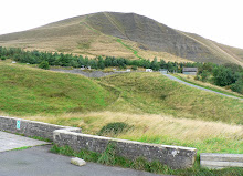
Our last full day in The Lakes had arrived, and whilst there was still plenty to see and do within the Eskdale/Wasdale regions, we wanted to take the opportunity to see more of Cumbria before we left. We also wanted to check out the Roman Fort that holds commanding views over Eskdale Valley ... but access to both was up the Hardknott Pass, the steepest road in Britain. The photos I'd seen online looked impressive, and the route exciting but fairly benign. The notice we'd seen at the bottom of the pass looked a little less impressive, it read, 'Road suitable for cars and light vehicles only 4 miles ahead. Unsuitable for all vehicles in winter weather'. Well, it was still Autumn, just, and the route would provide much quicker access to the Langdale Pikes, Derwent Water, Crummock & Buttermere and the other 'must sees' on our itinerary. The weather was cold but dry, our car was pretty robust and the driver experienced. Unfortunately the passenger (aka me) was of a nervous (soon to be petrified) disposition!
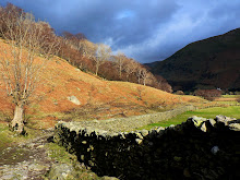
We left the valley and started our ascent. The first of the 12 hairpin bends was reasonable, and after a few more we pulled over into a small designated parking area to explore the Hardknott Fort ruins, 800' above sea level, and providing the opportunity for panoramic shots of the Eskdale Valley that we wouldn't otherwise have seen. The fort was most likely built in the early 2nd century to command the pass from Ambleside to the Roman fort and port at Ravenglass. It stands in such a strategic position that it would have been difficult for marauding locals to spring a surpise attack. History aside, the site certainly offered impressive views of the Eskdale and Upper Eskdale Valleys, both of which we were now quite familiar!
Back on the hairpin route once more, the crazy 1:3 (33%) gradient and razor sharp zig-zags rose alarmingly above us, or as one cyclist put it, "the road ahead rears up like a startled stallion." But we tried so very hard to ignore the burnt tyre marks scorched onto the tarmac, and instead remained focused on the salient fact that the higher we climbed, the narrower the road became and therefore the decrease in passing places!
The inevitable happened. A car approached us from 'above', zig-zagging it's way down the now single track road towards us. We had 3 clear options. To pull over onto the precipice, to reverse backwards down a perilously steep section towards a passing place, or to force the other car to reverse vertically up the road to 1289' above us. The first option would probably have sent shock waves down the valley with my screams; the second would have quietened me, as I would have blacked out, and the third just wasn't physically/mechanically possible for the passing car as it wasn't a 4-wheel drive. So we stopped, we rolled back a little way, we let the car pass, we tried to move forward, we left a few tyre imprints behind, and we continued with gritted teeth and clenched muscles, hoping against hope that we were over the worst bit.
Now whilst we didn't have any further major encounters with on-coming vehicles, the tension didn't lift for some 3.5 miles. This is the total length of the 2 passes and the Duddon Valley, which when combined provide one long spectacular white knuckle ride, giving adrenalin junkies their kicks, and giving worry junkies like me their worst nightmares. Somehow we made it to the top and as we drove between Hardknott and Harter Fells, there was another set of obstacles laid out before us. I must at this point apologise for the lack of spectacular photos as we approached the top of Hardknott Pass, but you will appreciate it's difficult to operate a camera when your fingers are tightly clenched and regular breathing is put on hold!
However, the views down Duddon Valley were duly noted, but silently. I was in survival mode, and was reserving all vocal chord energies for potential emergencies, or until the white knuckle ride had ended safely! We wouldn't be returning via this route, that was for sure!
But as with any good retrospective story, it was a truly memorable, if not repeatable experience, and the dramatic landscape over the pass and through the Duddon Valley were well worth the trauma. And, of course, we were soon driving around the pretty country lanes in Langdale ... still speechless and traumatised you'll understand ... but looking forward to some strong coffee in Ambleside!
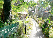
The transition from 'trembling' to 'giggling' was made possible courtesy of a charming Coffee House called 'The Giggling Goose'! This delightful place was part of The Old Mill House in North Ambleside, and came complete with working water wheel, babbling stream from Rydal Water, a tree-lined walkway, outside eating area, and it's own tame Robin. Oh, and the huge homemade scones and fresh coffee come highly recommended too!
After a quick forage in 'Blacks' for some new walking socks, and the obligatory hunt for a fridge magnet depicting Wastwater (no tourist shops in Wasdale!), we set off towards Derwent Water, and more specifically, Ashness Bridge.
Said to have graced more calendars than many other Lake District views, Ashness Bridge is a perfect example of a traditionally built stone packhorse bridge, and provides an even more perfect foreground to the superb views of Derwentwater and the peaks of Skiddaw and Blencathra beyond. As we were there 'out of season' we had this picture perfect view largely to ourselves - with the exception of the elderly lady in a bright red cardigan who innocently sat down on her picnic rug next to the bridge and enjoyed her sandwiches, who seemed not to notice or wonder why various camera lenses were pointed in her direction!
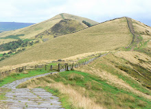
We moved on to Ashness Wood and followed the scenic footpath to a cliff edge point known as Surprise View. From this vantage point there were more stunning views over Derwentwater, but what captured my attention in particular was the fell on the other side, and people walking up it. Thanks to Julia Bradbury, we were familiar with the climb up Cat Bells after 'walking it with her' one evening on BBC2 TV! As we had a list of 'possible walks' on the itinerary for the day, Cat Bells seemed an ideal choice, so we left Ashness Bridge and found our way to the base of our next challenge.
There appeared to be 2 main routes up Cat Bells. We chose the most vertical one, simply because we chose the wrong one! However, climbing up the sheerer grassy face of the fell had it's advantages - it was a more direct route to the summit, and it was also probably quicker, even taking my many stops into consideration. Once on the main 'saddle' of the fell, we headed off towards the summit, which seemed altogether higher and further away, the closer we got to it!
As grass gave way to chalky boulders, and the gradient significantly increased, it became clear that the next stage of the ascent required hands as well as feet, a good steady balance, and a strong head for heights! With Wainwright's words ringing in my ears, "Catbells is ... a family fell where grandmothers and infants can climb the heights together," I scrambled onwards and upwards, but at this point felt unable to stand up without losing my balance, let alone climb the remaining section. The final push to the summit was still some way off, but I could see the route not only steepened, but narrowed considerably. Being practical and basing my judgement on the premise that 'discretion is the better part of valour', I decided that to continue would be foolish for me. Wainwright clearly didn't have a problem staying upright at height!
Feelings of disappointment and frustration at my own shortcomings were fairly shortlived and soon gave way to exclamations of amazement at the spectacular panorama of fells, lakes and valleys which stretched out before us like an oil painting on a giant canvas. We chose the descent which took us along the spine of Cat Bells, a route that was not without a few obstacles, but one which gave us maximum exposure to the magnificent scenery and photo opportunities around us. By the time we got back to the car it was late afternoon, but with one last 'must see' on the itinerary and only an hour or two of daylight left, we needed to move fast.
The last section of our journey entailed driving north, then west, to Buttermere and Crummock and thereby completing the penultimate section of our 'circular tour' around the more remote and therefore less touristy Western/Central Lakes. What I hadn't fully appreciated was just how remote Buttermere and Crummock are in terms of access. As the crow flies Buttermere is probably only 10 miles or so due North of Wastwater, but with restricted access, time and fading light against us, we only had 1 option open to us - to drive on yet another Mountain Pass
Whinlatter Pass forms part of a very scenic, but steep and twisting section of the B5262. It winds its way througb Thornthwaite Forest, 1042' above sea level, and is flanked by a number of impressive fells, one of which is Grisedale Pike. Hence the journey was slowly and carefully undertaken. Once at Buttermere we headed straight towards our objective - I wanted to see first hand the much photographed view of the 'Buttermere Pines' and their reflections in the southern edge of the lake, and of course to take some of my own. With the famous craggy peaks of Haystacks towering 1959' above us, this was an unexpectedly awesome view and one I was sorry to leave so quickly, but not before making a mental note to return to this idyllic spot in the future, and what's more, to see it from the top of Haystacks!
With nearly 30 miles still ahead of us and with darkness quickly falling, we beat a hasty retreat back, past Loweswater, eventually finding the A5086 south, at last picking up the A595 and finally along a myriad of single track roads which snaked their way back into the Western Lakes region and to the Eskdale Valley.
We couldn't leave the Western Lakes without one last visit to Wastwater. So after fond farewells to our cottage, to Penny Hill Farm. the chickens, the 3 sheepdogs, the cat, and the beautiful Eskdale Valley we set off down the now familiar 12 mile scenic route into Wasdale for one last look and maybe a walk. There wasn't time to see more of Mosedale, Scafell, Illgill Head or any of the other grand fells lining Wastwater, so instead we went to the head of the lake to the pyramid shaped peak that lies at the centre of 'Britain's favourite view'.
Great Gable had several route options to it's 2300' summit from Wasdale Head, so choosing the most accessible and gentle of these we tentatively decided to see how far we could climb in the time available to us. We walked for about an hour, had a picnic with a stunning view, but didn't achieve much in terms of height. However our walk was a gentle introduction to the imposing Great Gable, a great way to leave the Wasdale Valley and to end our lovely week in this remote and magical part of Cumbria! With Buttermere, Haystacks, Ennerdale and Scafell already on our 'must see next' list, we will be back ... !