In our case the choice was narrowed down by certain key criteria. It had to be a quiet and un-commercialised location, positioned fairly centrally to allow easy access to surrounding areas, with outstanding natural landscape all around and with a choice of walks on the doorstep. As the last two criteria are pretty much a given anywhere in Cumbria, we just wanted somewhere peaceful and picturesque!
Within walking distance of Patterdale, surrounded by peaks and valleys, unspoilt by overt commercialism and yet within 5 short miles of the M6 and of Helvellyn, the village of Glenridding in Ullswater ticked all our boxes! Our accommodation was on the shores of Ullswater, the lake curving gently through nine miles of magnificent mountain scenery opposite the hotel, and what's more, there was a path curving around the foothills, waiting to be walked!
Our plan was to follow the 7 mile path to Howtown, then to pick up the lake steamer to Pooley Bridge before returning 'full steam ahead' back to Glenridding. So with a hearty hotel breakfast inside us we set off down the lane to the village of Patterdale, following the shores of Ullswater until we reached the head of the lake. Here the path crossed fields and a small beck, before taking us to the foot of Place Fell (657m). Our walk then hugged the shores of the lake before climbing gently across the undulating contours of the lower fell, (very Wainwright!).
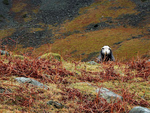
Although we hadn't climbed far up the fell, we enjoyed pretty views back across Ullswater to Glenridding. We also came across a beautiful pure white, but rather ghostly looking horse on the path, and after stopping to say hello continued on our way. But as we walked on, I felt compelled to keep looking back, feeling sure it would have mysteriously vanished, back to the ethereal fantasy world from which it had obviously come. But it was still there. Maybe the falling mist was playing tricks on my eyes!
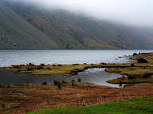
We continued along the foothills of Birk Fell and Sleet Fell, until they finally dropped us into the tiny village of Sandwick, which seemed to consist of a row of pretty terraced cottages, a handful of hungry sheep and a tiny stretch of sand with a huge view on the shores of the lake. After stopping to admire the pretty but misty views across Ullswater, the route then wound it's way back up through Hallinhag Wood along the base of Hallin Fell (388m).
By the time we reached Howtown several hours had passed and we were pleased to stumble into the Howtown Hotel, where we enjoyed liquid refreshment in a tiny little daffodil-filled garden, (very Wordsworth!). With thirsts quenched but calves still tender we hobbled down to the jetty where our steamer, The Lady of the Lake, was waiting to transport us. Sadly the mist had descended on the lake obliterating all scenic views, but we nevertheless enjoyed our sail across Ullswater, through ever thickening mist, past various keen kayakers, and back to the jetty at Glenridding,
Glenridding is surrounded by peaks, the most dramatic of which is Helvellyn, flanked to the south east by the famous and renowned ridge, Striding Edge. At 949m, Helvellyn is not only the second highest mountain in the Lakes and in England, but it also happens to be located just 4 miles west of Glenridding and our hotel. The most common route to Striding Edge is from Patterdale, and it was from here that our second walk began.
Okay, so I confess it was never our intention to climb up the mighty Helvellyn nor across the precipitous Striding Edge! We'd planned instead a lovely walk that was not too taxing, nor too steep, nor even too long, just a pleasant 4 mile undulating walk in the Grisedale Valley behind and between Patterdale and Glenridding.
On a gloriously sunny day in April we set off from our hotel along the winding lane that curves around Ullswater for about a mile to the pretty village of Patterdale. Once we'd located our bearings, and the footpath, we turned off the road and followed the trail along the lower contours of Glenamara Park, with lofty views of Arnison and Black Crags (622m) above us to our left, sweeping views along the Grisedale Valley ahead, and the wooded Keldas (322m) up to our right - a 360 degree stunning backdrop to our walk.
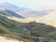
At around the half way mark we followed the path downwards into the valley basin at Thornhow, where we crossed Grisedale beck before the climb back up the other side of the valley. At this point it was just as if the whole area was a stage set for a stunning light show. And when the performance began, one hill after another was floodlit by swathes of golden sunlight all the way down the valley.
We headed up the valley towards Birkhouse Moor, a ridge that runs the length of the Grisedale valley, separating Glenridding and Patterdale Commons, and emptying into the head of Ullswater. There are small pockets of mixed woodland on the lower slopes and above these the valley wall is steep sided with some outcropping rock. Our route skirted Birkhouse Moor, taking us upwards, eastwards and through the pine-clad hillsides of Keldas.
Keldas is separated from the main body of Birkhouse Moor by a small depression containing Lanty's tarn. This small body of water has taken it's name from Lancelot Dobson, an earlier landowner. It was later bought by the owners of Patterdale Hall, the Marshall family, and extended by damming. In addition to fishing, the tarn was used as a source of ice in winter, and the ice house still stands nearby. The summit of Keldas is privately owned but public access is permitted. Standing above the head of Ullswater it provides superb views down the lake, with the 'Keldas Pines' giving an excellent foreground for pictures.
The last leg of our walk was the gradual descent back into Glenridding village, where, in stark contrast to the natural colours of the landscape in which we'd walked, we lunched in an bistro with bright orange walls covered in equally vibrant artwork - but the food was delicious!
One of the smallest, shallowest and prettiest of the lakes in the lake District, Brothers Water is only about half a mile from tip to toe, and less than 1/4 mile wide. They say this lake can be classified in two ways: one of the Lake District's smallest lakes or one of it's largest tarns! Dorothy Wordsworth referred to Brothers Water as "... the glittering lively lake ...'. I just think of it as one of Cumbria's hidden little precious gems, and one that outshines many of it's flashier neighbours! However, it does have a rather sad, tragic history.
The lake was originally called Broad Water, a strange name, considering it's diminutive size, but it was apparently renamed in the Victorian period after two brothers were tragically drowned in the lake. Brothers Water is now owned by the National Trust, who manage it as part of a natural preservation scheme aimed at conserving the ecology, flora, and fauna of the area.
Our walk began at Cow Bridge, just north of Hartsop, off the A592. We followed the waymarked trail around the western perimeter of the lake to our left and through the thickly wooded skirts to our right, which on occasions overspilled onto the shore. But there was always a view to be had - of the picturesque pink and green patchwork fells across the lake, of their reflections in it's glassy surface, or of the reed beds at the northern head of the lake, creating more interesting patterns, and no doubt vital nesting homes for numerous breeds of water birds.
As we reached the head of the lake the valley floor became green, and the fell slopes became all shades of green, pink and mauve, including the trees! As we followed the trail further we reached the medieval farmhouse of Hartsop Hall, a pretty 15th century dwelling, now owned by the National Trust but leased to a local farmer.
We didn't see the farmer, but met his herd of friendly and photogenic black cows! Not to be outdone, one of his sheep also muscled in for a photo shoot, going one better by providing us with a duplicate reflection! A little further on we came across the ruined remains of a dry stone wall sheep pen. Not medieval but it made a lovely frame to my photograph!
The south end of Brothers Water is particularly stunning, probably due to the unusual proportions of width and height within the valley - it's narrowness versus the height of 'High Hartsop Dodd', the majestic mountain, positioned at the head overlooking the whole valley. Standing at the foot of the High Hartsop Dodd seemed to create an 'Alice in Wonderland' illusion of a mountain much higher than it's 519m. This really is a breathtakingly beautiful little self-contained gem of a valley which must be hard to beat.
Any original intention we might have had of taking a circular walk was somehow lost at this stage, along with all signs of the trail. So rather than adding unnecessary miles to our walk, and equally unnecessary aches to our legs, we decided to hedge our bets and retrace our steps back to Cow Bridge and the car park.
But, thanks to Mother Nature, the return journey was by no means a 'repeat' walk in reverse. We were about to discover that this beautiful valley could get even better!
It's a well known fact that the weather can change very quickly and dramatically in the Lake District, but this is usually regarded as a negative 'turn for the worse'. When the weather 'turned' on that late afternoon in March, the whole valley metamorphisised.The previously pallid grey of the sky turned a deep moody blue, long shadowy fingers descended into the valley feeling their way along the fell contours, shafts of sharp sunlight hit seemingly selected trees with the intensity of a laser beam, flooding their dark shapes and turning them a brillian gold, in stark contrast to the darkening valley behind.
This was the alternative side of Brothers Lake - threatening, powerful, moody, dramatic - but completely awesome.
















No comments:
Post a Comment